• This topic has 7 replies, 6 voices, and was last updated 10 years ago by irc.
Viewing 8 posts - 1 through 8 (of 8 total)
  • aviemore to braemar via glen feshie
  • seosamh77
    Free Member

    Couple of questions, planning a cairngorms loop at the end of July, basically the top circle on the cairngorm challenge.

    Questions about glenfeshie, is it better to head up the west or east side? And what bridge is it that’s not there any more? Carnachuin or the one before that(ill be doing the loop anticlockwise I think. Also further up where the path disappears on Google earth, is the bridge there ok? and is there a path on the ground?(ive gps to find my way about so should be fine but just curious).

    Also relating to the bits from braemar to tomintoul to aviemore, anything else I need to be concerned about? Thinking any dodgy river crossing or dodgy bridges?

    meikle_partans
    Free Member

    I cant remember there being any problem when I did it a couple of years ago with no thought and the description/maps from the Wild Trails books coast to coast route. I vaguely remember the bridges being signposted (something like ‘cross here, there isn’t a bridge further on’ something like that, I cant remember). There is a proper path the whole way through to Braemar, with plenty of annoying water bars later on. Basically it wasn’t a drama. Bit vague, sorry!

    Chew
    Free Member

    If you’re thinking of following the loop its better to follow it clockwise, as it will flow better.

    Aviemore to Tomintoul is reasonably straight forward. There is one river crossing, but its fairly tame. Theres also one bit thats not very clear on the map, but reasonably clear on the ground.

    Nothing to worry about on the run between Tomintoul and Braemar.

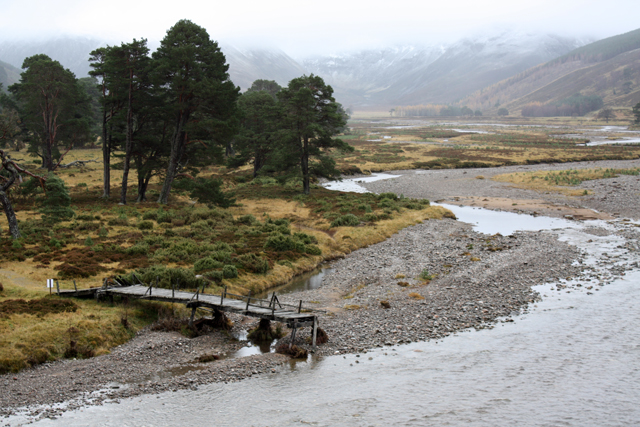
    Theres a defined track once you leave the double track after Braemar, which will take you to the bridge. The bridge is fine (it looks a bit wonky though) or you can ford the river further down stream if you wanted to.

    The bridge at Carnachuin doesnt exist, but you theres a good track on the eastern side of the river until you get to the road at Achlean.

    Go early if you can as Midge season will be in full flow late July

    scotroutes
    Full Member

    There’s a choice of routes around NN861901. Either cross the river twice on the landie track, or stick to the North/East bank of the river and take a little piece of thin singletrack across a bit of a landslip (TJ and I went up last year to clear some rubble and make it simpler). Just after that there’s a wide ford that’ll take you to the other side and then a very good estate road all the way up the West bank. It’s more fun on the East bank though, The bridge at Carnachuin is that one that’s been washed away.

    seosamh77
    Free Member

    Cheers all, will go clockwise then, and I know the bit you are talking about between aviemore and tomintoul, I had that bit in mind specifically when asking. Will try to keep to the east side was wondering about that dotted line too, good stuff.

    Re midges, no worries there, well versed in them.

    chickenman
    Full Member

    Scotroutes has it in a nutshell: If you’re in a hurry cross over to the west bank (half a mile after the landslip), otherwise stay on the east bank.
    The Geldie/Feshie watershed is fairly hard going for a few miles (around the Eidart bridge)unless you’re riding in drought conditions.

    seosamh77
    Free Member

    just back, pretty wise decision to take a pair of ‘wet’ shoes! did it clockwise(ie down the river feshie and stuck east to achlean ), cracking route!

    irc
    Full Member

    It’s that Carnachuin bridge down. You can wade the river near there in low water conditions (my 80 yr old dad managed it) if you want to use the tarmac eatate road up to that point.

Viewing 8 posts - 1 through 8 (of 8 total)

The topic ‘aviemore to braemar via glen feshie’ is closed to new replies.