- This topic has 255 replies, 8 voices, and was last updated 4 years ago by MarcSussex.
-
A Quantock Hello – Some indepth Qs about the area
-
jam-boFull MemberPosted 7 years ago
That map above. Ride straight across the road at dead woman’s ditch car park and into the woods. Drops down in a gully. Opens out just before where it meets concrete block.
canopyFree MemberPosted 7 years agoand thats the rocky horror #2?
so rocky horror #1 wouldn’t be hit the way i’ve been going from narnia -> sharki+jambos -> mid way down chimney?
jam-boFull MemberPosted 7 years agoNever heard the one by dead woman’s ditch called rocky horror.
The one by triscombe is the bridleway.
canopyFree MemberPosted 7 years agoI think i get where #1 is now.. its the second forest path/bridleway one you cross if you do narnia then sharki and jambos? all places i’m about to explore 🙂 i’ve not done the dunca’s secret passing/puddles/full chimney route yet, or “the bone yard” (which i think I saw someone higher up to the right riding down when I was crossing one of the roads down n+s+js)
the DWD ref for #2 I pulled from one of dibbs old posts so hopefully he’ll be back soon!
the ‘new’ #3 one is what someone called it on strava, the northern descent from between higher hare knap and lower hare knap that drops you end the end of somerton combe
DibbsFree MemberPosted 7 years agoAnother one (No 4?) used to enter the woods somewhere near the R in Robin Upright’s Hill, but I haven’t ridden it in the best part of 20 years and what was a “horror” on a rigid bike with canti brakes may not be much of a problem now.
canopyFree MemberPosted 7 years agothats excatly what your OS ref put #2 dibbs cheers 🙂 (still 3! phew!)
so there are a handful of rocky descents off/around robin uprights hill ..
going clockwise..
– concrete block
– DWD one on the map (probably!)
– rocky horror #2
– the other track running down into robin uprights
– old devils galloping pathSOAPFree MemberPosted 7 years agoI thought these trails were all Secret?
They will all be 4″ wide at this rate 😉canopyFree MemberPosted 7 years agotruth is.. triscombe aside – there aren’t enough people riding anything that isn’t in the guidebooks for that! 😉
north of the DWD/CPG road I rarely see people in places other than the main ridge track, weacombe/holford edge/ladies edge/stert+somerton/smiths/higher hare knap/frog (either one) and the upper great bear crossing (why!? :))
if my obvservations and strava are anything to go by.. concrete block, slaughterhouse, bin combe, willoughby cleeve (QQ aside) are only used by a handful of riders. i certainly don’t see many off those main routes in the first list.
i often see the same 10 or so faces over the course of a months riding, and a similar number of people i never see again, but i do try to mix it up and have a healthhy amount of new (to me) ground under my tyres
ARTFull MemberPosted 7 years agoif my obvservations and strava are anything to go by.. are only used by a handful of riders. i certainly don’t see many off those main routes in the first list.
… think I may have said this before [ahem] but it is possible to go riding without strava and to ride for a whole day at the same time as other people and amazingly not see anyone.
What I liked about all the trails on the Qs from riding them over many years was that people explored and found them and well you know, just rode them. Only now there’s the internet and pics and maps and strava an’ all –
They will all be 4″ wide at this rate
Canopy is the new Knottie, only with maps & descriptions for the masses rather than the nice pics of bikes & posts – I claim my tuppence 😉
ARTFull MemberPosted 7 years agoIn my misty eyed reminiscence they were more ‘artwork’ with vague ‘directions of travel’ .. 😀
canopyFree MemberPosted 7 years agolove em 😉
Canopy is the new Knottie, only with maps & descriptions for the masses rather than the nice pics of bikes & posts – I claim my tuppence
ohh shit.. if you saw my fb + strava ride pics… 😡
‘every week a peak’ n all that!got a bit bored of bikes n posts now though.. my last strava ride picture was of my kittens?
btw if i hadn’t been posting pics like that on fb I wouldn’t have two old friends riding with me regularly now at all. it helps get people start riding which is great.
… think I may have said this before [ahem] but it is possible to go riding without strava and to ride for a whole day at the same time as other people and amazingly not see anyone.
of course! until i got my HRM strava (and before it mapmyride) was for post ride analysis of where I got WAY lost! turned on at the start, tucked it in my pack and unpacked and uploaded at home.. and reviewed where i went.. sometimes drawing shapes so i could find them in the traces.
fact is though. strava’s stats for segments, and their global heatmap clearly show that people favour the routes i listed. even if 30% of riders used strava, the proportions still matter. (fact is 90+% of people I know use it..)
What I liked about all the trails on the Qs from riding them over many years was that people explored and found them and well you know, just rode them. Only now there’s the internet and pics and maps and strava an’ all –
i still found a bunch of stuff all on my own with an OS map, or just going another way to avoid people on horses etc. those accidents led to me googling and asking for more, and the likes of sharkis old posts on here helped find a group of people who’ve been there and done it, and are still doing it!
i’m a ex-skateboarder (only stopped 3 years or so ago properly) and i used to know every skatepark and small town skatespot within an hours drive of taunton. every weekend ,and some evenings we would pick a string of random towns/villages and target every school, industrial estate and likely town centre buildings looking for “somewhere good”. the M.O is still the same I guess!
get out explore, have fun. 😉
canopyFree MemberPosted 7 years agoUnexpectedly back at the tox tomorrow after 2 cry off tomorrow’s trip elsewhere (one ill, one out tonight chasing skirt).. The remainder will be exploring Triscombe and showing my mate down Narnia & s&j’s etc.. If anyone’s about – I ride a dark blue Santa Cruz Full Susser – say hi!
Btw I was hunting for other knottie spider maps , looks like he hasn’t posted for a while but I’m sure I saw him and his son in the spring
SOAPFree MemberPosted 7 years agoCanopy as you know all the names what’s the (newish) trail next to the chimney called? Steep loose switchbacks.
canopyFree MemberPosted 7 years agoI’m only just starting learning my way round great wood & triscombe but I think that ones called witches cauldron
Learned that from this video which does Narnia and s&j’s to mid chimney before going over into it instead of left at the sign?
[video]https://youtu.be/YtYuATMtSpQ[/video]
That it?
canopyFree MemberPosted 7 years agohi knottie 🙂
just having a pre-ride coffee before heading off to grab a mate and head on up!
what are you riding these days? i’m sure we’ve said hi at least once, if not a few times!
jam-boFull MemberPosted 7 years agoShow us a spider map then 😉
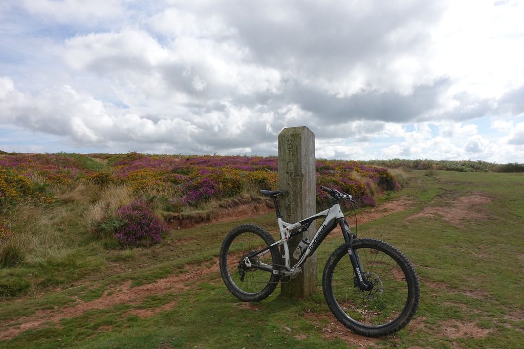
I did a bicknoller post photo when i was up a few weeks ago

Didn’t recognise most of the top of that video until it popped into the gully.
That new section off the chimney looks better than the xmas tree line that used to be accessed off that corner.
canopyFree MemberPosted 7 years agoDidn’t recognise most of the top of that video until it popped into the gully.
i think i read it got felled/replanted a while back? certainly looks very different from the bit in quantocks sessions video, the gully was the thing that made me recognise it in that too. the sign by the gully in the newest video says something like “trail changed ahead for safety”.. there’s a similar sign at that point where it crosses the chimney saying the trail exit there has changed, they turned the chimney exit right at the bottom so the trail doesn’t come straight out and scare people but and runs along side the road now instead, spitting people out parallel
for funs 🙂 almost up to date pic, bike has dark blue pedals now though (and little mud guards)
SOAPFree MemberPosted 7 years agoYep that’s the one actually starts from the double track just along from the start of chimney.
Proper gnarly trail at speed
The gully now has the choice of the old or the newer trail to the right.davesmateFree MemberPosted 7 years agoYou could join the MB Swindon lot on thir Quantocks ride at the end of the month. They may be able to show you some new stuff or, at the very least, introduce you to some like minded folk.
canopyFree MemberPosted 7 years agota. not sure i’ll keep up! did 20 miles & 3000m (900m) elevation today, which is rare (Defo getting fitter!).. Did actually steal some locations off one of their routes for today. i’ll do that after 😀 😀
did bits some around great wood/triscombe today including.
– finding (not doing!) the’ triscombe gap thats in all the videos.. its a lot bigger than it looks on video!
– narnia + sharki+jambos + lower chimney
– dunc’s secret passage, puddles, sams trail / full chimney
those rocks in the upper chimney must be nasty as hell when wet!
– came UP what i assume is rocky horror 😉took my mate over to somerton and did bincombe on the way back, somones cleared the downed tree i was going to try move. woop!
Yep that’s the one actually starts from the double track just along from the start of chimney.
Proper gnarly trail at speed
The gully now has the choice of the old or the newer trail to the right.might be the one that now has a sign on saying its been closed off by the FC? only saw two trails off that side.. one was too far back to have been it as it was where sams trail spits you out
canopyFree MemberPosted 7 years ago*3000ft 😉
not found anything that suits our style of riding much on the south side of cockercombe road in triscombe so far, which is to be expected as its mostly DH stuff. don’t really know where to look. but i think we’re more into ‘natural’ trails / singletrack than man made jumps and berm fests 🙂
canopyFree MemberPosted 7 years agoi’m still exploring 🙂 had a weekend where everyone bailed due to the weather or previous weeks OTBs etc..
it was soggy due to the previous days rain but I finally did the DWD to holford combe route, old devils galloping for the first time in 2 years, I went ‘up’ the frog singletrack, and did “enduro stage 1” which is south west of DWD accessd via a small gate and crosses a fireroad (i’d always gone down through a track 1/2 east with a stile and dropping to the fireroad,and doing another descent to ramscombe) and explored behind dowsborough a little. even got to try out my folding saw for fallen tree that was blocking a track and couldnt be tucked any other way
whats left on my ‘todo’ list right now..
– heading from the fireroad at ramscombe over to st davids well (narnia area) there are at least two trails down (i think) if you go rights at the top of the first climb and there is the “mini chimney” on the way back from the same point in the other direction. so thats 3 for me to find.
– learn more of triscombe
– the farm descent near wills neck
– theres another trail that runs off of higher hare knap and drops onto ‘horizon’ further up from the frog singletrack ( https://www.strava.com/segments/6951301 )
– farm descent near wills neck
– some bits around cothelstone my mates found, which i’ve done very little of on footand when i’m really bored..
– behind combe house hotel theres a track.. i know the ‘straight over’ lower hare knap, and the track left, just never been right
– exploring what happens you go go ‘left’ after smiths, mainly just looking around that LHS side of smiths as you look down from beacon hill (i already did the deer park section and perry combe..that’ll keep me busy over winter
found an old post by sharki mentioning a descent called “half hitch” aka knotties trail..
http://singletrackworld.com/forum/topic/of-chipps-and-the-quantocks-stw-forum-ride/page/2
any idea where that is?
jam-boFull MemberPosted 7 years agono idea where half hitch is and I think I probably went on that ride.
saw this earlier. some frog combe, stert combe and bin combe on there.
[video]http://www.youtube.com/watch?v=wOMxWLtZNy8[/video]
always been jealous of their house at the bottom of cockercombe.
canopyFree MemberPosted 7 years agonice video . i’d love to live anywhere within a 15 min ride inside the main core of the tox. growing up had a schoolmate that lived on the edge of adscombe and used to stay there sometimes.
here what should be an easier one.. a post by sharki just reminded me.. which bit did people used to call “the esses”? my mate says his cousin took him down it 15-20 years ago and he has no idea.. probably around triscombe/great wood?
canopyFree MemberPosted 7 years agoridden a few new bits from the wishlist
– bone yard. a man made technical trail parallel to narnia with lots of small jumps.. too much for me, but its nice to be in narnia and see someone higher up on the hillside coming across it
– two trails that run from up above quantock combe down onto the fireroad that leads to st davids well / rocky climb up towards narnia/bone yard. the one that comes out nearest the climb is the better one
– trail that is known as “mini chimney” that runs south to north down up above the higher ramscombe fireroad – definitely my favourite of the new batch by far
still can’t find what the “esses” is, or know what knotties trails is/was..
this weekend might be my first solo one for a while, if it is i’m going to explore around smiths as there seem to be various interesting looking bits on the satellite imagery
jonostevensFree MemberPosted 7 years agoWhat are the trails like at the moment canopy? Aiming to be moved in within the next fortnight and got a week before I start my job so hoping to sneak out at some point…
canopyFree MemberPosted 7 years agohey 🙂
didn’t make it out this weekend, for the first time in months. week before last the stuff around great wood/triscombe was starting to get slippery, but nothing too bad.
in general the quantocks dries out really well, there a few places that get boggier, especially the lower parts of combes.
you got any idea where you’ll be heading out from and is there anthging you really want to ride? can try help with a rough route for you to follow 🙂
btw although strava is good for pre-ride/post-ride looking at stuff, when you’re actually out ther the Trailforks app (by pinkbike) is the best to find trails by
jonostevensFree MemberPosted 7 years agowow, trailforks looks pretty powerful!
Thanks for the route offer – it’s the Cothelstone area I’m interested in exploring at the mo. I’ll be riding in and out from there to get onto to the main trails, so be nice to find a good descent from there towards Bishops Lydeard before I hit the tarmac home.
DibbsFree MemberPosted 7 years agoI live in Lydeard and I’ve been riding the Quantocks for more than 20 years, give me a shout if you want a guide for the basic layout of the place.
jonostevensFree MemberPosted 7 years agoThanks Dibb. Have ridden loops out of Nether Stowey when on holiday, taking in Slaughterhouse, Smiths, Weacombe, Stert & Somerton and finishing with Bin Combe, but will be coming in from Halse so at the opposite end (same end to you presumably?).
canopyFree MemberPosted 7 years agowow, trailforks looks pretty powerful!
I might just happen to be the regional admin for the quantocks too. 😉
but its great because its open source, anyone can add/alter/adjust trails. (like strava, but democratic!)
I put some nice pics on the frog combe singletrack page the other week.
Thanks for the route offer – it’s the Cothelstone area I’m interested in exploring at the mo. I’ll be riding in and out from there to get onto to the main trails, so be nice to find a good descent from there towards Bishops Lydeard before I hit the tarmac home.
when he doesnt drive his bike up to lydeard hill car park my friend has been riding up from taunton to cothelstone and found “ball lane” however it descends back on the buncombe hill (wrong side).
most people i know that come up from taunton seem to start riding from lydeard hill car park and head north. (its a short ride to the man made stuff in triscombe, and the triscombe car park is a ball ache to drive to). if you get can up to there easily enough its a good starting place. (its not true, but in my mind the quantocks start at lydeard hill)
just has a peek at his strava, and the guy i said about before who lives in oake seems to return via terhill lane, and go up via west bagborough.
obviously dibbs will know the nicest route up!
first time out, I suggest aiming straight for the lydeard hill car park/wills neck area by going up this way https://www.strava.com/segments/4017599?filter=overall (the guy in the #1 spot is the one from oake) just follow the “ridge” trail as far as you can handle north and turn around and come back down it.
that’s going to be the backbone of almost any ride you do, a good idea to familiarise yourself as after mid morning you can head towards the sun and end up back on it.
easy deviations
– it passes through triscombe car park, there you could drop down to the narnia/chimney section/fireroads into great wood and head back up the fireroads to either crowcombe park gate (CPG) (on the ridge trail) or dead womans ditch (DWD) which is a bit over to the east
– drop into any one of the northern combes (ones north of DWD/CPG) and come up up ladies edge/sheppards combe)
– ride the ridge north to bicknoller post, above weacombe – do the descent and loop back up round through staple plain car park)
canopyFree MemberPosted 7 years agoyou posted at same time as me 🙂 missed the window to edit, but obviously, once you’re north of the road by CPG/DWD you’re hitting territory you’ve done before. so looping down from triscombe stone area through narnia / chimney etc would give you bit of the good stuff before coming back to CPG and the main ridge trail (macmillan way)
DibbsFree MemberPosted 7 years agoApart from the jumpy stuff at Paradise the Cothelstone Hill tracks tend to get cut up by horses if it’s the slightest bit wet. There’s usually a few weeks in the spring when the ground dries out due to the lack of leaves on the trees.
canopyFree MemberPosted 7 years agoyeah i walked the buncombe side a bit in the summer.. very boggy even then, and does not look well used at all. strava stats+heatmap show that hardly anyone rides there.
btw on the trailforks front.
– you can still use strava, and link to trailforks, it’ll auto import
– you can import a strava ride to crop to make into a trailforks trail (or a gpx etc)
– its mapping system has a heatmap feature which is awesome for seeing whats popular.
– the mobile app pre-downloads regional maps so you dont need a mobile connection when out in the wildbtw trailforks is not like strava, has a very different role, and its ‘competitive’ leaderboard timings etc are quite broken. its just about sharing trails. the goal is for trail groups to have real usage stats for their work with local authorities.
also as far as the quantocks go, on trailforks i leave or talk to the ‘TRC’ (triscombe riders collective) about changes to their trails, everything else is me. i’ve tidied up what was there already, just working on improving and maintaining.
jonostevensFree MemberPosted 7 years agoSuper, thanks chaps. Off sick with a bug today so think I’ll light the fire and do some more OS map geeking.
I like the idea of finishing a ride with a few runs of the jumpy stuff at Triscombe. Slightly embarrassed to admit it but if I can’t find some nice stuff through Cothelstone I might end up driving to Crowcombe and riding from there. will probably take me 30 mins to ride and with the family etc that’s over an hour extra on the trails before I have to head back!
DibbsFree MemberPosted 7 years agoI aim for around 25 minutes to ride to Lydeard Hill and 8 minutes to get back.
If I ever drive up there I firstly feel guilty for driving and secondly it takes me several miles before I’m properly warmed up.

The topic ‘A Quantock Hello – Some indepth Qs about the area’ is closed to new replies.